Sistema Ibérico / Moncayo, (Europa , Spain)
Region coordinates
| Latitude | 41.78 DD |
| Longitude | -1.84 DD |
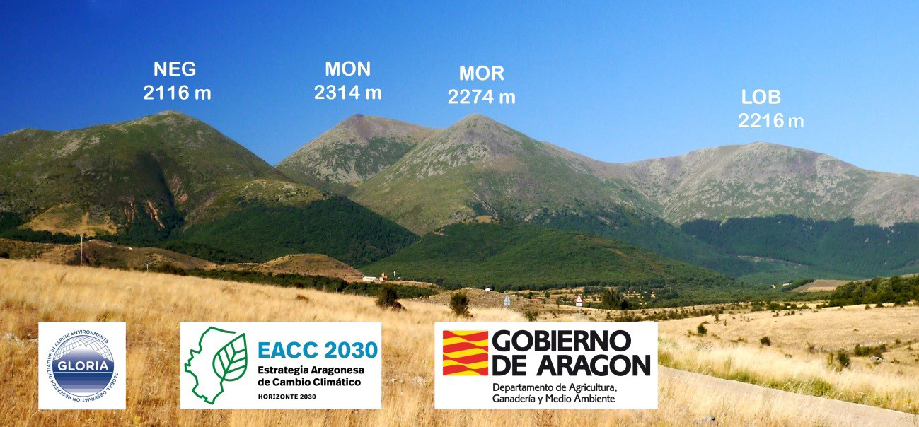
Summits
| MON | 2314 m | subnival (alpine-nival ecotone) |
| MOR | 2274 m | alpine (or lower/upper alpine ecotone) |
| LOB | 2226 m | alpine (or lower/upper alpine ecotone) |
| NEG | 2116 m | lower alpine |
Short description & land use (current/history)
The four selected peaks are part of the same mountain range, the Moncayo. The pilot area is a representative of the high mountains of the Iberian Mediterranean climate. Historically it has been grazed by sheep and cattle. In recent times it has fallen livestock. The impact on tourism (hiking, mountaineering), is moderate in the upper summit, Pico de San Miguel or the Moncayo, which shows an access hiking trail to the top.
Vegetation boundary lines
In this mountain are represented two vegetation belts: oromediterranean and crioromediterranean. This Mediterranean mountain receives some Atlantic influence.
There are some plantations of Pinus uncinata and Pinus sylvestris that reach 1800 m of altitude.